| Ref |
Subject |
Description |
Size |
Price |
Image |
| Mx0368 | Yorkshire | J Cary; Part of the West Riding of Yorkshire c1793. Hand colouring. | h 210mm x w 270mm | £35 | 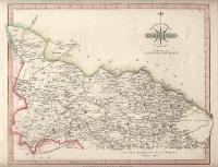 |
| Mx0367 | Yorkshire | J Neele; North Riding of Yorkshire c1844. Published by Fullarton & Co. This map shows the railway line through York and Darlington which opened north of Darlington in 1844. | h 185mm x w 240mm | £35 | 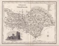 |
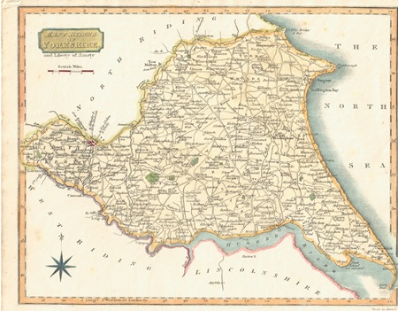
| MX0460 | Yorkshire | East Riding of Yorkshire and Liberty of Amsty, 1818. Engraved by Neale and published by J Robins & Co. Engraving with later hand colouring. | h 197mm x w 247mm | £35 |  |
| MX0447 | Yorkshire | Yorkshire, 1824. Published by G & W B Whittaker. Steel engraving. Condition - vertical folds as issued. | h 180mm x w 213mm | £16 |  |
| MX0445 | Yorkshire | Yorkshire. Parts of the East & West Riding, c1845. Drawn and engraved by J Archer for Dugdale's "England and Wales Delineated". Steel engraving. Condition - central vertical fold as issued. | h 178mm x w 234mm | £16 |  |
| MX0425 | Yorkshire | Leigh / Hall, Yorkshire Nth Riding, c1835. Published in Leigh's "New Atlas of England & Wales". Copper engraving. | h 70mm x w 122mm | £12 |  |
| M0377 | Yorkshire | Christopher Saxton and William Hole c1607 Eborcacensis comitatus....pars Orientalis vulgo East Riding. This was the second edition of this map to be published as it has no text on the reverse. Copper engraving with early / original colouring. This copy has a small hole just outside the top left hand margin. | h 200mm x w 250mm | £230 | 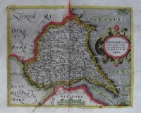 |
| M0376 | Yorkshire | Christopher Saxton and William Hole c1607 Eborcacensis comitatus pars Occidentalis vulgo West Riding. This was the first edition of this map to be published as it has text on the reverse. | h 26895mm x w 320mm | SOLD | 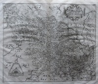 |
| M0374 | Yorkshire | Christopher Saxton and William Kip c1610 Eborcacensis comitatus pars Septentriolanis vulgo North Riding. This was the second edition of this map to be published. It differs from the first edition in that it has no text on the reverse. | h 195mm x w 344mm | £250 | 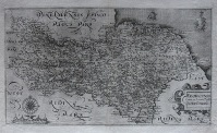 |
| M0369 | Yorkshire | J Ellis; A modern Map of the North Riding of Yorkshire. Drawn from the latest Surveys: Corrected & Improved by the best Authorities. c1764. | h 193mm x w 242mm | £45 | 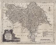 |
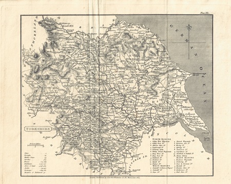
| M0138 | Yorkshire | Moule, T c1836. These maps appeared in several editions. This is a later edition which shows numerous railway lines. These maps are considered to be the last decorative county maps to be issued. Includes vginette of Harewood House. Later hand colouring. | h 195mm x w 265mm | £65 | 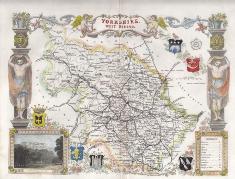 |
| M0119 | Yorkshire | John Speed, c1614 or later York Shire issued by John Sudbury & George Humble, English text on reverse. | h 375 x w 510mm, | £650 | 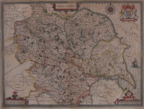 |