| Ref |
Subject |
Description |
Size |
Price |
Image |
| Mx0299 | Leicestershire | J & C Walker, Leicestershire, c1835. Original outline hand colouring. | h 188mm x w 244mm | £15 | 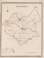 |
| Mx0298 | Leicestershire | Seller / Grosse, Leicestershire, c1786. | h 123mm x w 145mm (of map) | £18 | 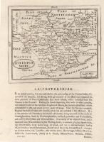 |
| Mx0282 | Leicestershire | Creighton, R and Walker, J & C. Leicester town plan, published in Samuel Lewis's Topographical Dictionary of England, 1835. The plans were originally produced to illustrate the boundaries of boroughs in relation to the great Reform Act of 1832. Steel engravingwith original hand colouring. | h 183mm x w 236mm | £12 | 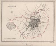 |
| M0303 | Leicestershire | T Badeslade & W Toms, c1741. A Map of Leicester Shire. These maps appeared in several editions. Copper engraving. | h 153mm x w 140mm | £35 | 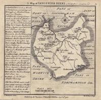 |
| M0300 | Leicestershire | Moule, c1848 Leicestershire. These maps appeared in several editions. This is a late edition which shows the railways radiating out from Leicester. These maps are considered to be the last decorative county maps to be issued. | h 185mm x w 260mm | £35 | 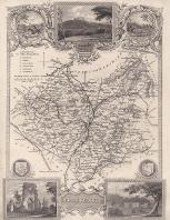 |
| M0297 | Leicestershire | Seller / Grosse, Leicestershire, c1786. Later colouring. | h 123mm x w 145mm (of map) | £25 | 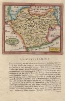 |
| M0296 | Leicestershire | Thomas Kitchin, Leicestershire, Drawn from the Best Authorities and Regulated by Astron. Observations c1750. Later colouring. | h 167mm x w 215mm | £40 | 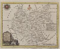 |
| M0294 | Leicestershire | J Ellis, A Modern map of Leicestershire, Drawn from the latest Surveys; Corrected & Improved by the best Authorities c1766. Outline hand colouring. | h 192mm x w 245mm | £45 | 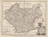 |
| M0279 | Leicestershire | Seller, John, 1701 issue. Copper engraving. | h 121mm x w 148mm | £38 | 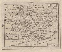 |
| M0278 | Leicestershire | Emman Bowen, c1761 The Counties of Leicestershire & Rutland, Divided into Hundreds. Containing the County and Market Towns, Rivers, Roads, Distances etc by Emman: Bowen Geogr. to His Majes. Published in the "General Magazine of Arts & Sciences for Wm Owen" Copper engraving. | h 170mm x w 190mm | £35 | 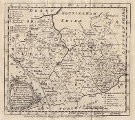 |
| M0149 | Leicestershire | Badeslade & Toms, c1742 or later. A map of Leicestershire, north from London. The text gives details of principal towns, market days, Members of Parliament, etc | h 153mm x w 145mm | £38 | 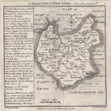 |


