| Ref |
Subject |
Description |
Size |
Price |
Image |
| Mx0120 | Isle of Wight | Thomas Moule, 1836 Isle of Wight; These maps appeared in several editions and are considered to be the last decorative county maps to be issued. Later hand colouring. Good margins. | h 204mm x w 265mm | SOLD | 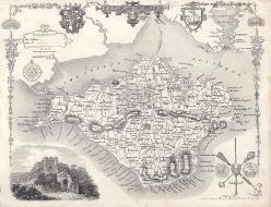 |
| Mx0110 | Isle of Wight | John Seller,c1695. Trimmed close to border on left-hand side,otherwise very good copy. | h 118mm x w 143mm | £55 | 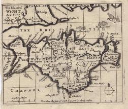 |
| Mx0100 | Isle of Wight | Seller / Grose, c1787 Grose published this map in his "Supplement to the Antiquities of England and Wales" using John Seller's map of 1695. Text continues on verso.
| w 148mm x h 120mm (of map) | £26 | 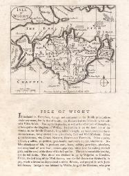 |
| M0118 | Isle of Wight | H Moll, c1770 The Isle of Wight, | h 195mm x w 215mm | £75 | 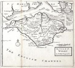 |
| M0101 | Isle of Wight | Thomas Kitchen, c1764; A New map of the Isle of Wight drawn from surveys. | h 177mm x w 1237mm | £56 | 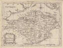 |


