| Ref |
Subject |
Description |
Size |
Price |
Image |
| Mx0126 | Hampshire | Cooper, c1808 Hampshire | h 100mm x w 180mm | £20 | 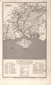 |
| Mx0112 | Hampshire | Moll, H, c1724 Hamp Shire. " versions of this map were produced one with, and one without the map bordered by antiquities. This is the version with the antiquities. | h 190mm x w 310mm | £150 | 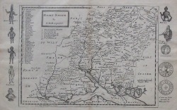 |
| Mx0111 | Hampshire | Michael Drayton, c1613 Hampshere, from Drayton's Polyalbion.
| h 253mm x w 335mm | £420 | 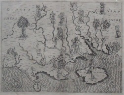 |
| Mx0098 | Hampshire | Moule, c1836 Hampshire. These maps appeared in several editions. This is a later edition which shows the railways from London to Salisbury, Southampton and Gosport and also eastwards from Havant towards Brighton. These maps are considered to be the last decorative county maps to be issued.
| h 195mm x w 255mm | £55 | 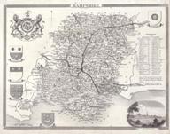 |
| Mx0093 | Hampshire | Emman Bowen, c1755 Hampshire divided into hundreds containing its City, Boroughs & Markettowns with the roads and distances | h 175mm x w 190mm | £50 | 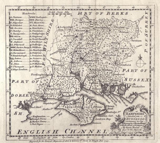 |
| Mx0089 | Hampshire | Owen Bowen, c1720 A Map of Hampshire. On the revere is a strip map showing the road from Cockermouth to Carlisle. | h 220mm x w 140mm | £45 | 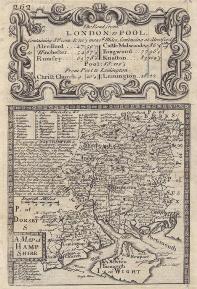 |
| Mx0088 | Hampshire | van Der Keere, c1620 Southampton | h 84mm x w 122mm | £120 | 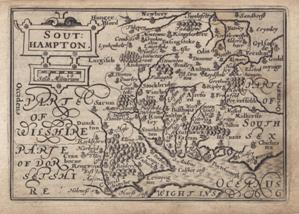 |
| Mx0086 | Hampshire | John Bill, c1626 Hant Shire from an abridged edition of Britannia | h 92mm x w120mm | £450 | 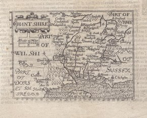 |
| Mx0085 | Hampshire | Thomas Jenner, c1643 A curious miniature map of the county, including a table of distances. Originally produced for Jenner's "A Direction for the English Traviller" | h 105mm x w 105mm | £120 |  |
| M0330 | Hampshire | Ogilby, John. No 25 - The Road from London to Lands End c1675. This strip map shows the road from London to Andover. Later hand colouring. Mounted | h 290mm x w 310mm | £360 | 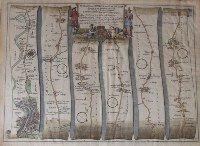 |
| M0329 | Hampshire | Ogilby, John. No 51 - The Road from London to Southampton c1675. This strip map shows the road from Bagshot via Farnham, Alton, Alresford to Southampton; and also from Southampton via Romsey to Salisbury. Later hand colouring. Mounted | h 324mm x w 432mm | £250 | 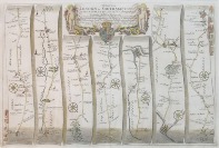 |
| M0328 | Hampshire | Norden /Hole c1637 Hamshire olim pars Belgarvm. This was the last edition of this map to be published. Unlike the first edition it has a plate number and a plain back. Later hand colouring and mounted. | h 290mm x w 310mm | £380 | 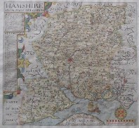 |
| M0247 | Hampshire | Speed,John, Hantshire described and devided, pub. J.Sudbury & G.Humble,c1611, hand coloured map, with inset town plan of Winchester,English text on verso | h 375 x w 510mm, | £995 | 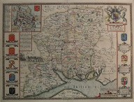 |
| M0131 | Hampshire | Dower, I, c1840 Environs of Portsmouth, from Mudie's History of Hampshire. Small tear to top of image. | h 195mm x w 215mm | £12 | 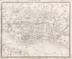 |
| M0129 | Hampshire | Dower, J. c1839 Environs of Southampton. From Mudie's History of Hampshire | h 134mm x w 200mm | £12 | 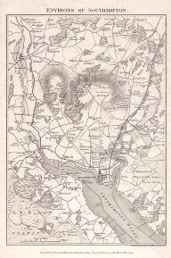 |
| M0128 | Hampshire | Anonymous, c1804 Southampton | h 78mm x w 130mm | £10 | 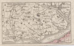 |
| M0124 | Hampshire | Creighton, R & Walker, J&C; c1835; Christchurch / Lymington; Two maps on one sheet, with original outline colour | h 255mm x w 184mm | £20 | 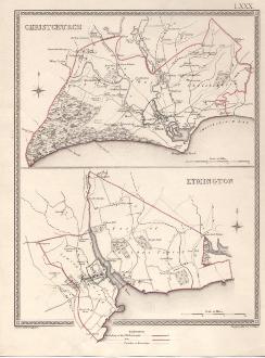 |
| M0113 | Hampshire | Dawson, Robert, c1832 Hampshire. This map shows the "Proposed Division of Counties and Boundaries of Boroughs". Original colour.
| h 255mm x w 230mm | £25 | 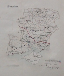 |
| M0108 | Hampshire | J Dower, c1839 Environs of Christchurch. From Mudie's History of Hampshire | h 134mm x w 190mm | £10 | 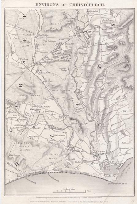 |
| M0107 | Hampshire | J Dower, c1839 Environs of Winchester from Mudie's Hampshire. | h 130mm x w 190mm | £10 | 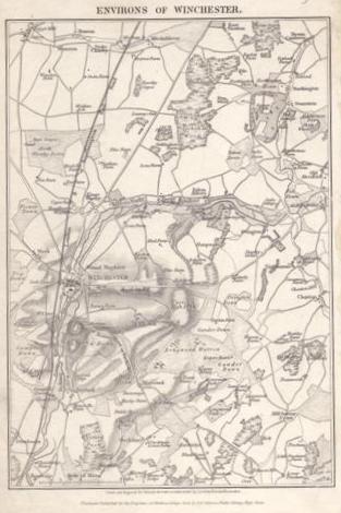 |
| M0106 | Hampshire | I Dower, c1840 Environs of Andover, from Mudie's History of Hampshire | h 190mm x w 132mm | £12 | 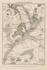 |
| M0105 | Hampshire | J Dower, c1840 Environs of Petersfield, from Mudie's History of Hampshire. | h 190mm x w 130mm | £12 | 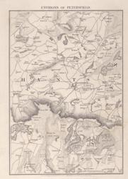 |
| M0103 | Hampshire | Richard Blome, A Map of Hantshire c1673 | h 298mm x w 260mm | £225 | 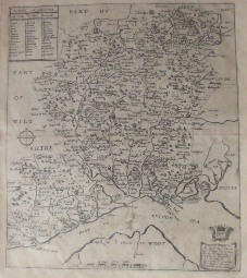 |
| M0099 | Hampshire | Moule, c1836 Hampshire. These maps appeared in several editions. This is a late edition which shows the railways from London to Salisbury, Southampton & Wimborn and Gosport and also eastwards to Portsmouth and Towards Brighton. Further railways go from Basingstoke towards Reading and from Reading towards Guildford & Reigate with a branch to Farnham These maps are considered to be the last decorative county maps to be issued | h 195mm x w 255mm | £50 | 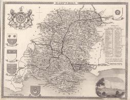 |
| M0087 | Hampshire | Aristide Perrot, c1823 Wiltshe - Hamp. The map was published in L'Angleterre, or description Historique et Topographique du Royaume-Uni de la Grande-Bretagne' by Etienne Ledoux,Paris,France, 1824 | h 109mm x w 68mm | £70 | 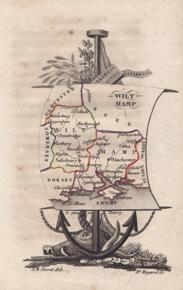 |
| M0060 | Hampshire | John Speed, Hantshire described and devided, pub. Overton, c1713, hand coloured map, with inset town plan of Winchester, 375 x 510 mm, blank on verso, framed | h 375mm x w 510mm | SOLD | image to follow |
| M0059 | Hampshire | John Speed, Hantshire described and devided, pub. John Sudbury and George Humble, c1627, hand coloured with inset town plan of Winchester, English text on verso, framed and double glazed | h 375mm x w 510mm | £1000 | image to follow |
| M0058 | Hampshire | John Speed, Hantshire described and devided, pub. J.Sudbury & G.Humble,1614, hand coloured map, with inset town plan of Winchester,English text on verso, framed and double glazed
| h.375mm x w.510mm, | SOLD | image to follow |
| 8 | Hampshire | Henry Teasdale; c1830 hand coloured and framed | | £85 |  |
| 15 | Hampshire | Robert Morden, c1695 Hampshire hand coloured and mounted. | | £250 |  |


