| Ref |
Subject |
Description |
Size |
Price |
Image |
| M0383 | France | Pieter Van der Aa, Carte du Gouvernement de Provence, c1814. Later hand colouring. | h 255mm x w 290mm | £90 | 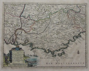 |
| M0195 | France | Michelot and Bremond, c1727 Plan du Port de Cette aux Plages du Languedoc en 1704. Engraved by P Starck. | h 172mm x w 251mm | £32 | 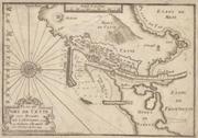 |
| M0194 | France | J Cary, c1781 Plan of Cherbourg with the Forts and Batteries when taken by the English in August 1758. Published by James Macgowan April 1781. | h 172mm x w 230mm | £35 | 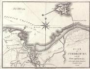 |
| M0191 | France | Ortelius, Abraham. c1601 Caletes et Bononienses | h 83mm x 122mm | £55 | 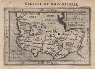 |
| M0190 | France | Abraham Ortelius, c1601. Auraicus Principatus | h 85mm x w 120mm | £55 | 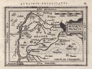 |
| M0189 | France | Abraham Ortelius, c1601. Burgundiaw Comitatus | h 94mm x w 117mm | £55 | 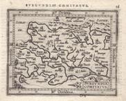 |
| M0188 | France | Giovanni Battista Vrients / Abraham Ortelius c1601. Blesiense Territorium
| h 80mm x w 107mm | £55 | 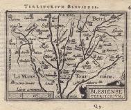 |
| M0187 | France | Abraham Ortelius, c1603 Turonensis Ducatus. [Tourrayne] | h 90mm x w 117mm | £55 | 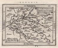 |
| M0159 | France | Thomas Kitchen, c1760. A Plan of the Harbour of Brest. Engraved for the London Magazine. Later hand colouring. | h 110mm x w 180mm | £18 | 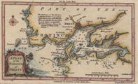 |


