| Ref |
Subject |
Description |
Size |
Price |
Image |
| Mx0342 | Cambridgeshire | J Wallis, Cambridgeshire c1712. Published by S Oddy. Copper engraving with original hand colour.. | h 262mm x w 178mm | £25 | 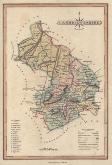 |
| Mx0341 | Cambridgeshire | Thomas Kitchin and Thonas Jefferys 1749-1775, A Map of Cambridgeshire, c1749-1775. Beneath the map is a description and list of towns and their market days. Copper engraving. | h 176mm x w 135mm | £48 | 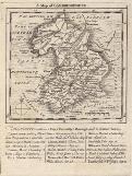 |
| Mx0340 | Cambridgeshire | Eman Bowen, The County of Cambridge containing the City & County Town with the Market Towns, River, Roads & Distances,1759 Engraved for the General Magazine of Arts and Sciences. Copper engraving. | h 195mm x w 173mm | £48 | 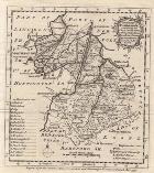 |
| Mx0339 | Cambridgeshire | J Wallis, Cambridgeshire c1814. Copper engraving with hand colouring. | h 134mm x w 95mm | £16 | 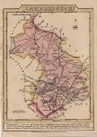 |
| Mx0338 | Cambridgeshire | Herman Moll, Cambridgeshire c1724. Copper engraving. Along the top and bottom of the map are engravings of Saxon Coins. | h 315mm x w 195mm | £100 | 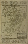 |
| Mx0337 | Cambridgeshire | Robert Morden, Cambridgeshire c1695 -1722. Copper engraving.
| h 425mm x w 355mm | £120 | 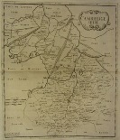 |


