| Ref |
Subject |
Description |
Size |
Price |
Image |
| Mx0347 | Worcestershire | J Roper; Worcester c1808. Published by Vernor, Hood & Sharpe. Copper engraving.
| h 232mm x w 184mm | £52 |  |
| Mx0283 | Worcestershire | Creighton, R and Walker, J & C. Dudley, Kidderminster, Evesham and Bewdley town plans, published in Samuel Lewis's Topographical Dictionary of England, 1835. The plans were originally produced to illustrate the boundaries of boroughs in relation to the great Reform Act of 1832. Steel engraving with original hand colouring. | h 235mm x w 183mm | £14 | 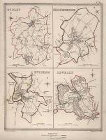 |
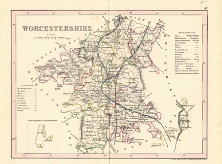
| MX0468 | Worcestershire | John Archer, Worcestershire, c1845. Steel engraving with outline hand colouring. | h 177mm x w 233mm | £15 | 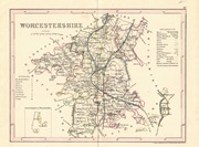 |
| M0295 | Worcestershire | Thomas Osborne, A Correct Map of Worcestershire, c1748. | h 145mm x w 170mm | SOLD | 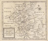 |
| M0277 | Worcestershire | Seller /Grose, c1787 Grose published this map in his "Supplement to the Antiquities of England and Wales" using John Seller's map of 1695. Text continues on verso. Copper engraving with orginal hand colouring. | h 115mm x w 135mm (of map) | SOLD |  |