| Ref |
Subject |
Description |
Size |
Price |
Image |
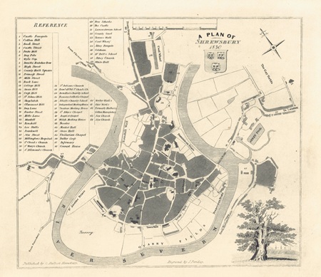
| MX0476 | Shropshire | A Plan of Shrewsbury 1830. Published by C Hulbert 1837. | h 175mm x w 198mm | £85 |  |
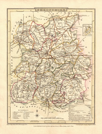
| MX0455 | Shropshire | Shropshire, 1808. Drawn by G Cole and engraved by J Roper. Published by Vernor, Hood & Sharpe in "The British Atlas" which accompanied the "Beauties of England & Wales". Copper engraving with later hand colouring. | h 230mm x w 175mm | £38 |  |
| M0392 | Shropshire | John Speed, Shropshyre described. The situation of Shrowesbury shewed with the Armes of those Earles and other Memorable things observed. Published by George Humble, c1627. Inset town plan of Shrewsbury. Copper engraving with later hand colouring. | h 382mm x w 500mm | £600 | 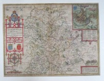 |
| 3 | Shropshire | Michael Drayton, 1612-1622, uncoloured map with allegorical figures issued in Drayton's Polyalbion. Framed | | sold | 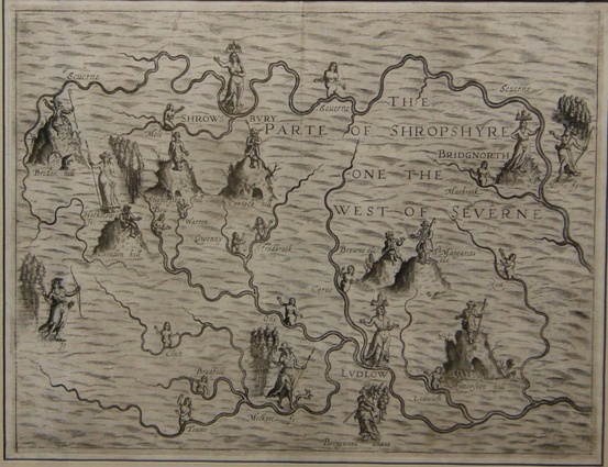 |