| Ref |
Subject |
Description |
Size |
Price |
Image |
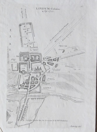
| PL0013 | Lincolnshire | Lindum Colonia (Plan of Lincoln), 4 Sept 1722. Drawn by William Stukeley for Stukeley's "Itinerarium Curiosum". Copper engraving. | h 277mm x w 174mm | £38 | 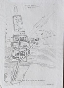 |
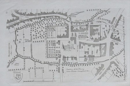
| PL0012 | Lincolnshire | Banovalium (Honcastle) Sept 1 1722. Drawn by William Stukeley for Stukeley's "Itinerarium Curiosum". Copper engraving.. | h 170mm x w 275mm | £48 | 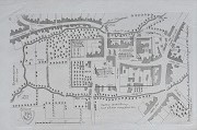 |
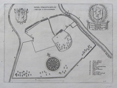
| PL0007 | Lincolnshire | Areae Spaldingensis Coenobii Ichnographia, c1655-1672. Engraved by Daniel King. Copper engraving. This plan of Spalding was published in either William Dugdale's "Monasticon Anglicanum" 1655 or "The Cathedrall and Conventuall Churches of England and Wales" 1672. | h 174mm x w 275mm | £32 | 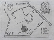 |
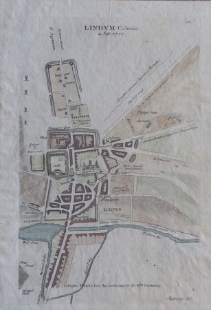
| PL0006 | Lincolnshire | Lindum Colonia (Plan of Lincoln), 4 Sept 1722. Drawn by William Stukeley for Stukeley's "Itinerarium Curiosum". Copper engraving with later hand colouring. | h 277mm x w 174mm | £45 |  |
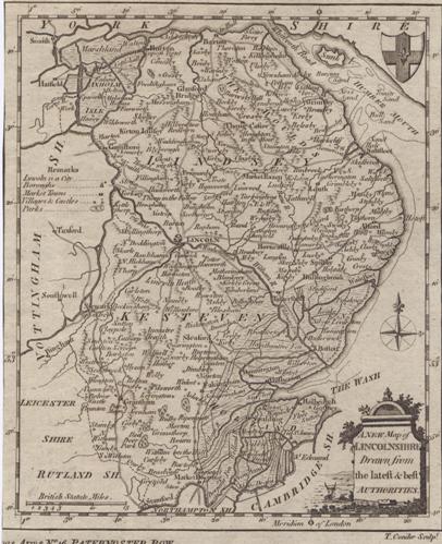
| Mx0286 | Lincolnshire | Thomas Conder, c1786 A New Map of Lincolnshire Drawn from the latest and best authorities. This map was published as a apair with another map, hence the lack of margin on the left-hand side. Copper engraving | h 188mm x w 155mm | £45 | 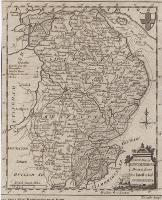 |
| Mx0284 | Lincolnshire | S Leigh,Lincolnshire, c1825. Engraved by Sidney Hall. | h 122mm x w 70mm | £18 | 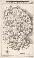 |
| MX0422 | Lincolnshire | Drawn by R Creighton and engraved by J & C Walker and published in Samuel Lewis?s "Representative History of England". This map was produced following the Great Reform Act of 1832 and shows the parliamentary boundaries, the places of election and the number of MPs returned. Steel engraving with original hand colouring. | h 248mm x w 187mm | £20 | 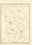 |
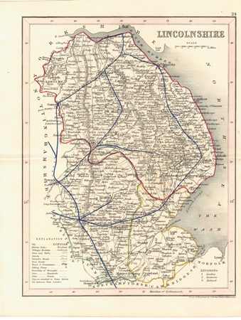
| MX0419 | Lincolnshire | John Archer, c1840 Lincolnshire. Published in Dugdale's Curiosities of Britain. Steel engraving. Earlyy hand colouring. Central fold as issued and some off-setting. | h 230mm x w 176mm | £12 | 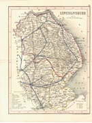 |
| M0293 | Lincolnshire | Thomas Moule, Plan of Boston. c1840. Published in "Moule's English Counties. Early hand colouring to plan. | h 175mm x w 243mm | £68 | 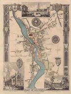 |
| M0292 | Lincolnshire | Thomas Moule, Plan of Boston. c1840. Published in "Barclays Universal English Dictionary. | h 175mm x w 243mm | £60 | 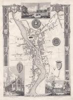 |
| M0291 | Lincolnshire | John Seller, c1701 Lincolneshire. Published in Camden?s Britannia Abridg?d. Copper engraving. Central fold as issued. | h 122mm x w 148mm | £65 | 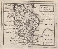 |
| M0289 | Lincolnshire | John Rocque, Lincoln shire, c1753, Copper engraving. | h 190mm x w 153mm | £40 | 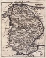 |
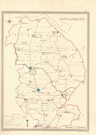
| M0287 | Lincolnshire | Thomas Moule, c1848 Lincolnshire. These maps appeared in several editions. This edition shows the extensive railway network. These maps are considered to be the last decorative county maps to be issued | h 255mm x w 202mm | £40 | 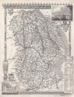 |
| M0285 | Lincolnshire | Thomas Kitchin, c1786 A New Map of Lincolnshire Drawn from the best authorities: By Thos Kitchin Geogr, Engraver to HRH the Duke of York. | h 257mm x w 196mm | £48 | 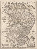 |
| M0285 | Lincolnshire | James Wallis, 1810. These small maps were first issued in Wallis's New Pocket Edition of the English Counties or Travellers Companion. Original hand colouring. | h 132mm x w 95mm | £25 |  |