| Ref |
Subject |
Description |
Size |
Price |
Image |
| Mx0345 | Lancashire | Sidney Hall, Ashton under Line, c1824. From a survey by George Piggot published in Edward Baines' History, Directory and Gazetteer of the County Palatine of Lancaster. Copper engraving with early hand colour. Ashton under Lyne is now part of Greater Manchester. | h 165mm x w 242mm | £48 | 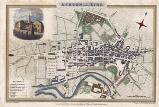 |
| Mx0344 | Lancashire | Sidney Hall, Blackburn c1824. From a survey by George Piggot published in Edward Baines' History, Directory and Gazetteer of the County Palatine of Lancaster. Copper engraving with early hand colour | h 165mm x w 242mm | £48 | 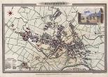 |
| Mx0343 | Lancashire | Sidney Hall, Bolton c1824. From a survey by George Piggot published in Edward Baines' History, Directory and Gazetteer of the County Palatine of Lancaster. Copper engraving with early hand colour | h 165mm x w 242mm | £48 | 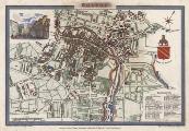 |
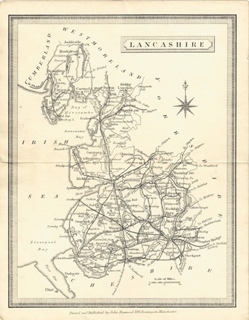
| MX0478 | Lancashire | Printed and published by John Heywood, c1858. Condition - horizontal fold as issued. | h 191mm x w 150mm | £12 | 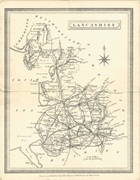 |
| M0147 | Lancashire | Adlard, A. c1855 Lancashire. Published by How & Parsons. Engraved map with later hand colouring. | h 200mm x w 133mm | SOLD | 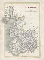 |
| M0146 | Lancashire | Archer, John; c1856, Lancashire, Engraved for Dudales England and Wales Delineated. Some later hand colouring. | h 235 x w 178mm | SOLD | 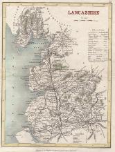 |