| Ref |
Subject |
Description |
Size |
Price |
Image |
| Mx0210 | Ireland | Adlard, c1841. Galway | h 137mm x w 207mm | £22 |  |
| Mx0204 | Ireland | Adlard, c1841 Tipperary and Waterford. Hand colouring. | h 198mm x w 136mm | £22 | 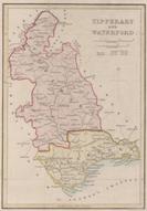 |
| M0209 | Ireland | Adlard, c1841 Kerry. Hand colouring. | h 136mm x w 203mm | £22 |  |
| M0208 | Ireland | Adlard, c1841 Limerick & Clare. Hand colouring. | h 136mm x w 203mm | £22 | 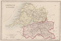 |
| M0207 | Ireland | Adlard, c1841 Wicklow, Carlow & Wexford. Hand colouring. | h 202mm x w 136mm | £22 | 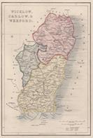 |
| M0206 | Ireland | Adlard, c1841 Mayo. Hand colouring. | h 135mm x w 197mm | £22 | 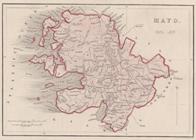 |
| M0205 | Ireland | Adlard, c1841 King's County, Quyeen's County and Kilkenny. Hand colouring. | h 198mm x w 138mm | £22 | 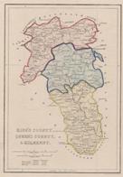 |
| M0203 | Ireland | Adlard, c1841 Sligo and Roscommon. Hand colouring. | h 198mm x w 138mm | £22 | 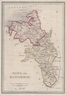 |
| M0202 | Ireland | Adlard, c1841 Donegal. Hand colouring | h 148mm x w 198mm | £22 | 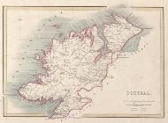 |
| M0201 | Ireland | Adlard, c1841 Cavan, Westmeath and Meath. Hand colouring. | h 147mm x w 198mm | £22 | 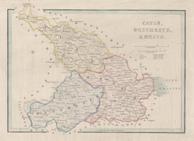 |
| M0170 | Ireland | van der Keere, c1612 Connacia,(Connacht) | h 84mm x w 124mm | £75 | 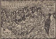 |
| M0068 | Ireland | Robert Morden; c1695, The Kingdom of Ireland | | £150 | 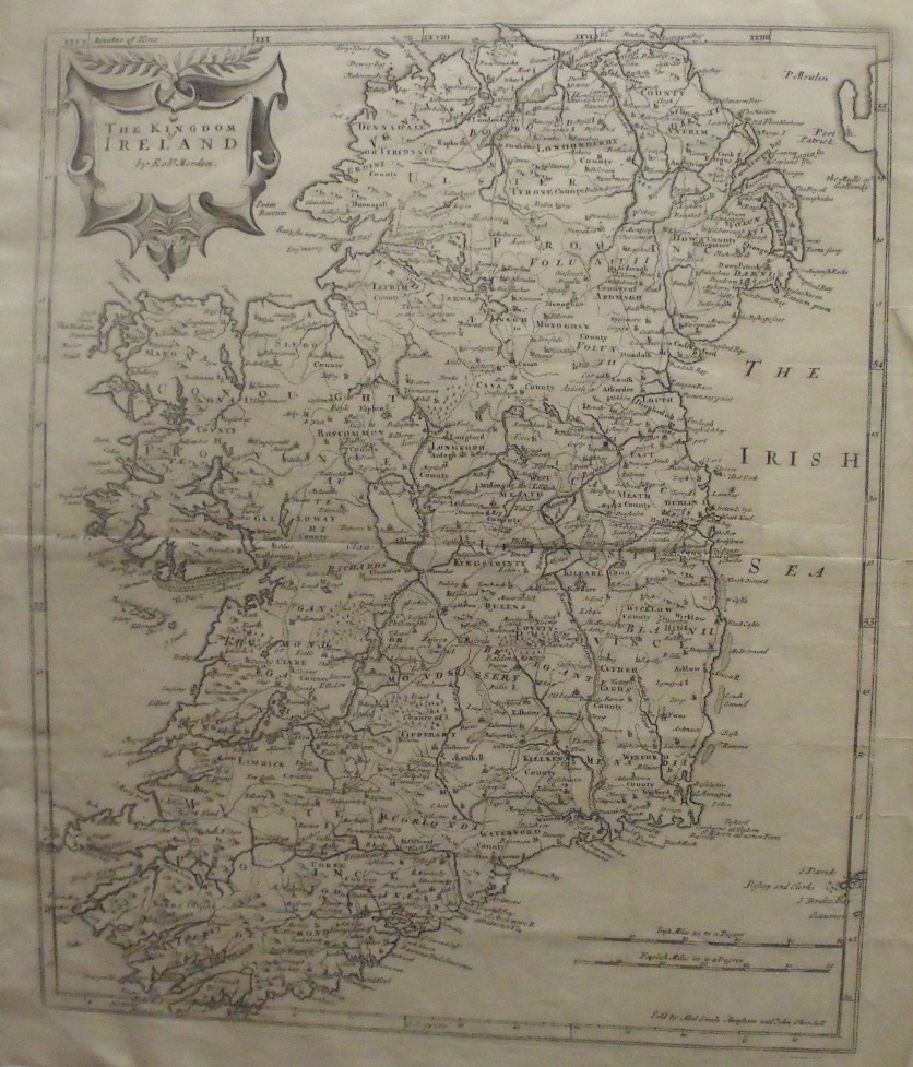 |
| 24 | Ireland | Robert Morden; The Kingdom of Ireland, c1695 mounted, uncoloured | | £150 |  |


