| Ref |
Subject |
Description |
Size |
Price |
Image |
| Mx0362 | Huntingdon | Thomas Kitchin, Huntingdon Shire, c1747-1760. | h 218m x w 180mm | £40 | 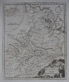 |
| Mx0361 | Huntingdon | Hermann Moll, Huntingdon-shire, c1724. | h 310m x w 195mm | £55 | 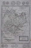 |
| Mx0360 | Huntingdon | John Cary, Huntingdonshire, c1787. Original outline hand colouring. | h 265m x w 215mm | £30 | 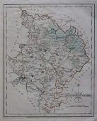 |
| Mx0359 | Huntingdon | Saxton / Kip c1610 Huntingdon comitatus qui pars fuir Icenorvm. This edition of the map has no text on the reverse. Good margins. | h 272mm x w 325mm | £125 | 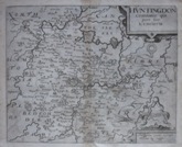 |
| Mx0357 | Huntingdon | J Rocque, Huntingdon Shire, c1769. | h 200mm x w 154mm | £25 | 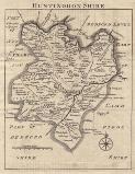 |
| Mx0356 | Huntingdon | J Rocque, Huntingdon Shire, c1769. Outline hand colouring. | h 200mm x w 154mm | £28 | 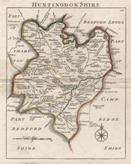 |
| Mx0354 | Huntingdon | James Wallis / S A Oddy, c1812. Wallis's New British Atlas was first published in 1813 Oddy. A second edition was published in 1816. This example is from the first edition and is dated 1812 on the imprint. Copper engraving with original hand colouring. | h 179mm x w 268mm | £25 | 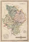 |
| Mx0353 | Huntingdon | Badeslade & Toms, c1742 or later. A map of Huntington Shire, north from London. The text gives details of principal towns, market days, Members of Parliament, etc. Copper engraving with original hand colouring. This map has been laid down on paper. | h 148mm x w 150mm | £34 | 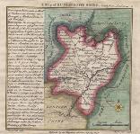 |
| Mx0349 | Huntingdon | Seller / Grosse. Huntingtonshire. c1773. Copper engraving. | h 123mm x w 147mm (Image) | £22 | 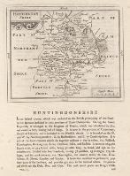 |
| Mx0336 | Huntingdon | Christoperher Saxton / William Kip, Huntingdon c1607. This edition has the Latin text on the reverse. Copper engraving.
The earlier Saxton map depicts Northants/Beds/Cambs/Hunts and Rutland, therefore this map is one of the earliest separate printed maps of the county. | h 275mm x w 340mm | £130 | 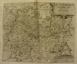 |
| MX0443 | Huntingdon | Huntington Shire, 1627-1672. By P Van Den Keere. Text relating to Northamptonshire on reverse, Copper engraving. | h 85mm x w 123mm | £45 |  |


