| Ref |
Subject |
Description |
Size |
Price |
Image |
| M0192 | Germany | John Walker, c1798 Germany. Engraved for Walker's Georgraphy. Engraved map with outline colour. | h 183mm x w 222mm | £35 | 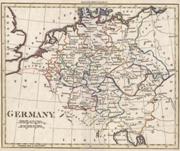 |
| M0184 | Germany | van den Keere, c1627 (or later). Germania | h 84mm x w 122mm | £75 | 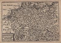 |
| M0183 | Germany | T Kitchen, c1760 Germany drawn from the best authorities. | h 192mm x w 212mm | £50 | 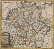 |
| M0178 | Germany | T Kitchen, c1760. A New Map of the Lower Rihne drawn from the best authorities. Later hand colouring. | h 248mm x w 183mm | £35 | 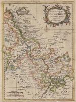 |
| M0177 | Germany | Germany, from the best Authorities copper engraved map with outline colour, c1818. Published in An Atlas to Guthrie's Geographical Grammar. | h 217mm x w 187mm | £18 | 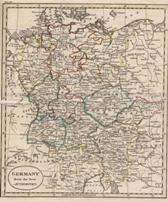 |
| M0161 | Germany | R Baldwin, c1756 A Map of Bohemia being the preent Seat of War in Germany. | h 165mm x w 228mm | £35 | 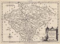 |
| M0153 | Germany | T Kitchen, c1756 A Map of the Southern Part of Upper Saxony with the Routs of the Prussian Armies | h 180mm x w 238mm | £45 | 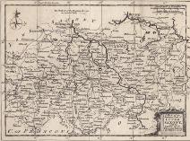 |


