| Ref |
Subject |
Description |
Size |
Price |
Image |
| Mx0415 | Cumberland | Mutlow, Henry. Plan of the City of Carlisle, 1816. Published by T Cadell and W Davies. Copper engraving. | h 248mm x w 192mm | £110 |  |
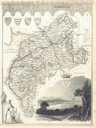
| MX0475 | Cumberland | Thomas Moule, c1841. Cumberland. This later edition shows several railway lines. Steel engraving. Condition - tears in left-hand margin where map was bound into the volume. | h 265mm x w 193mm | £45 |  |
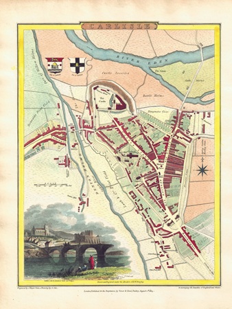
| MX0453 | Cumberland | Carlisle, 1805. Drawn by G Cole and engraved by J Roper. This attractive and detailed early 19th century plan of Carlisle has a vignette view of Carlisle with Cathedral, Castle and bridge. Published by Vernor, Hood & Sharpe in "The British Atlas" which accompanied the "Beauties of England & Wales". Copper engraving with later hand colouring. | h 230mm x w 177mm | £70 | 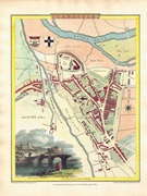 |
| M0390 | Cumberland | John Speed, Cumberland and the Ancient Citie Carlile described with many memorable antiquities therin found observed. Published by Bassett and Chiswell, c1676. Inset town plan of Carlisle. Copper engraving with later hand colouring. | h 385mm x w 560mm | SOLD | 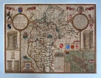 |